Photo Record
Images
Additional Images [69]
Metadata
Title |
TOWNS/MISC. SCENIC & GEOGRAPHIC, Lead, General Views No. 2 |
Date |
1900-1961 |
Description |
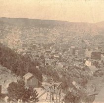
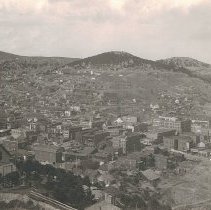
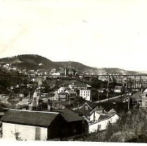
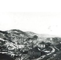
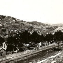
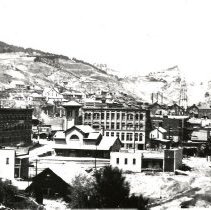
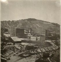
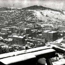
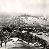
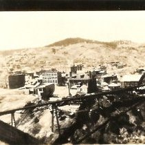
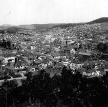
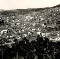
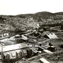
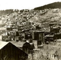
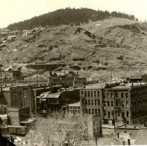
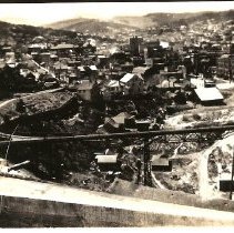
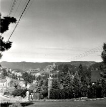
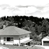
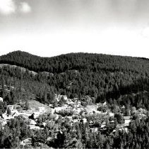
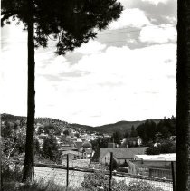
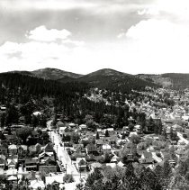
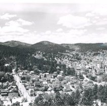
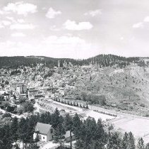
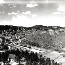
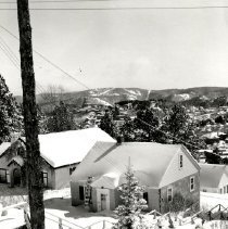
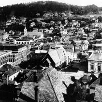
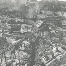
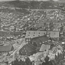
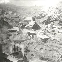
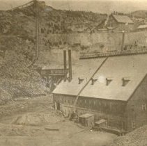
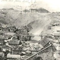
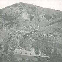
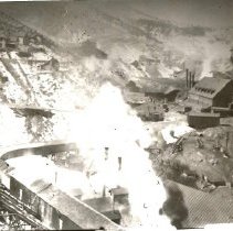
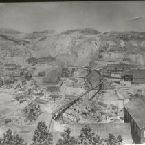
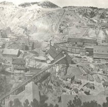
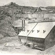
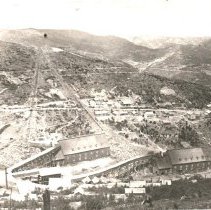
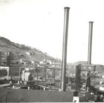
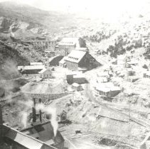
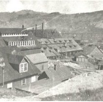
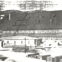
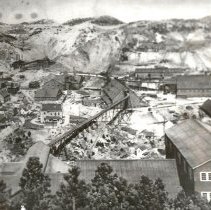
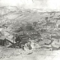
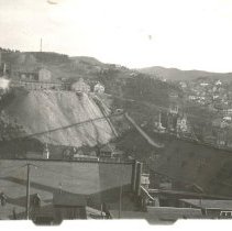
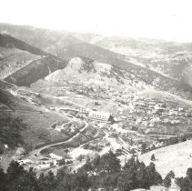
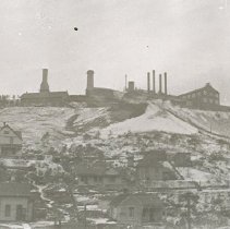
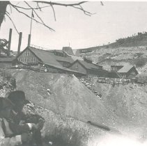
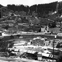
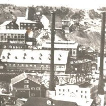
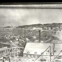
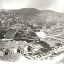
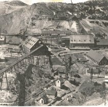
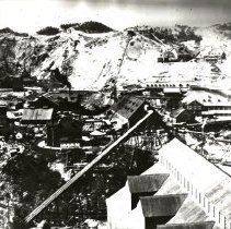
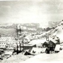
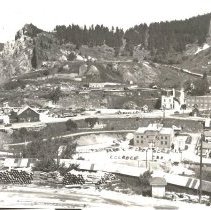
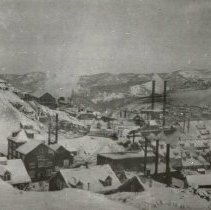
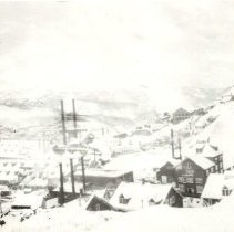
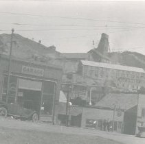
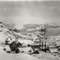
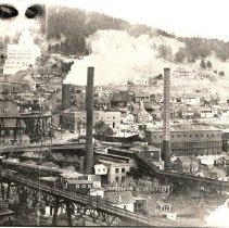
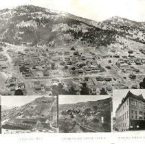
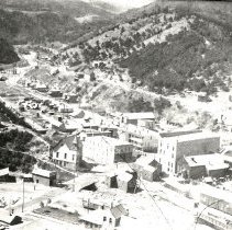
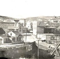
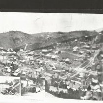
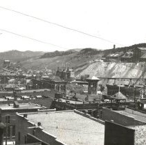
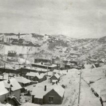
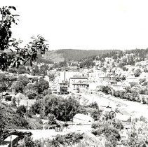
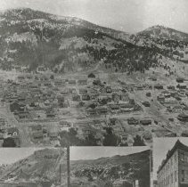
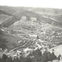
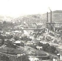
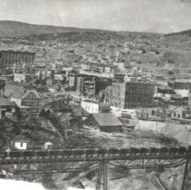
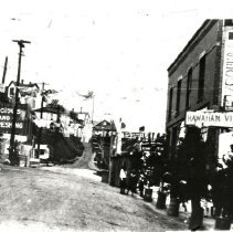
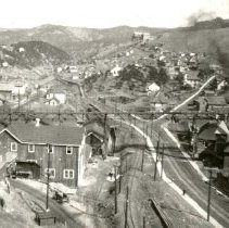
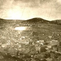
Series of photographs of general views of Lead. 479-2: Overhead view of Lead, 1908. The photograph was taken from Ellison. Donated to Homestake Mining Company by Henry Eyster December 1963. 479-3: Overhead view of Lead. 479-4: Overhead view of Lead. 479-5: Overhead view of Lead. 479-6: Overhead view of Lead. 479-7: View of Lead, 1920. 479-8: View of Lead. 479-9: Overhead view of the City of Lead. Sharp Bits November 1960 Vol. 11 No. 10 pg. 4 "When Lead was second in population in South Dakota. That's right, back in the early 1900's, Lead was next to Sioux Falls in population. In fact, it was about 1920 before Rapid City caught up to Lead. Certain historians and records indicate Lead was close to 10,000 population and when this photo was taken it was somewhere near that figure. Quite a business district, yes?" 479-10: Overhead view of Lead during winter. 479-12: View of Lead. 479-14: View of Main Street Lead with intersecting streets Gold, Bleeker, and Mill, early 1900's. Photo was taken from atop of South Lead reservoir. Sharp Bits July 1960 Vol. 11 No. 6 pg. 9 "Forty years ago (approximately) the center of Lead looked like this from atop of South Lead reservoir. Note the many large business buildings on lower Main Street, and intersecting streets Gold, Bleeker, and Mill. Also compare this photo with one taken this month (below)." 479-15: Overhead view of Lead. Similar image to 479-14. Written on the back is "Jan 62 S.B's." 479-20: Overhead view of Lead, 1932. Sharp Bits November 1960 Vol. 11 No. 10 pg. 16 top "The date on this photo? April 7, 1932. There were still many business buildings remaining in the "Open Cut" area, but demolition was underway. Incidentally, this removal of buildings, residences, etc., was a twenty-year project. It began in 1919 and was not fully completed until 1939. Smoke in this photo was from the Northwestern Railway's Depot at the intersection of Main and South Mill streets." 479-27: Overhead view of Lead. 479-28: Overhead view of Lead. 479-30: View of Lead taken by Black Hills Studios, Inc. 479-35: Overhead view of Lead. 479-36: View of Lead, 1957. 479-42: View of northwest from Addie Street in West Lead. Sharp Bits July 1960 Vol. 11 No. 6 pg. 26 "The march of time changes the vegetation and natural scenery in all areas. It also records man's efforts as he alters physical appearances of a community. That's a TV transmitting tower on top of the Mountain in back of Ridge road. This view was to the northwest from Addie Street in West Lead. 479-45: View of the Washington Addition, 1960. Sharp Bits July 1960 Vol. 11 No. 6 pg. 20 "Washington Addition is the largest of the very few comparatively level spots in the City of Lead. Moving a lawn in this part of town would be monotonously close to mowing lawns elsewhere. What a pity these residents don't have the debatable privilege of trimming grass on steep pitches as so their neighbors elsewhere in the city." 479-47: View of Lead taken from just above Fairview Avenue. Sharp Bits July 1960 Vol. 11 No. 6 pg. 11 "Another view of a small part of the Mile-High City, Lead. This photo was taken just above Fairview Avenue and while the camera barley records it, the human eye (best lens ever devised) can spot the very tip of Bear Butte just beyond the "V" on the horizon. Often mispronounced "led," Lead offers a multitude of spectacular views from many vantage points." 479-48: Overhead view of Lead. 479-49: Overhead view of Lead. 479-50: Open cut end of Lead, showing the slippage area, 1961. Contrasting the 1966 airplane view in that it is photographed from the opposite end of the business district. The small row of trees below the business houses and fronting the Open Cut marks the spot called the Sinking Gardens, a small park. Trees and a bend in the contour of the hills hide most of the residential homes. 479-51: Overhead view of Lead. 479-53: View of a house in Lead during winter. 479-55: Overhead view of Lead, 1918. Sharp Bits November 1953, Vol. 4, No. 10 pg. 7 "Is This a Trick Photo? - No indeed, it isn't. That's Lead alright. The Post Office, the Homestake Club Building, and the church in between are each very much in use today. However, the truth is, this photo was taken about 1918 when the Episcopal Church was located where the downtown parking lot is now situated. It was torn down in 1921-22 to make way for the Hearst Mercantile Store and subsequently rebuild "brick for brick: on upper Main Street." 479-56: Overhead view of Lead. 479-57: Overhead view of Lead. 479-58: Overhead view of Lead. 479-59: View of Homestake Mining Company building. 479-60: Overhead view of Lead. The photograph is captioned with "[Illegible] Gold Mine and Mills, Lead, S.D." 479-61: Overhead view of Lead. 479-62: View of Homestake Mining Company buildings. 479-63: Overhead view of Lead and Homestake Mining Company buildings. 479-64: Overhead view of Lead and Homestake Mining Company buildings. 479-65: View of Homestake Mining Company building. 479-66: Overhead view of Lead and Homestake Mining Company buildings. 479-67: View of Lead and Homestake Mining Company buildings. 479-68: View of Homestake Mining Company building. 479-69: View of Homestake Mining Company building. 479-70: View of Homestake Mining Company building. 479-71: Overhead view of Lead and Homestake Mining Company buildings. 479-72: Overhead view of Lead and Homestake Mining Company buildings. 479-73: Overhead view of Lead and Homestake Mining Company buildings. 479-74: Overhead view of Lead and Homestake Mining Company buildings. 479-75: View of Lead and Homestake Mining Company buildings. 479-76: A group of young men sit next to a tree and a building is up a hill behind them. 479-77: Overhead view of Lead and Homestake Mining Company. 479-78: View of Homestake Mining Company buildings. 479-79: View of Homestake Mining Company buildings. 479-80: View of Homestake Mining Company buildings. 479-81: View of Homestake Mining Company buildings. 479-82: View of Homestake Mining Company buildings. 479-83: View of Homestake Mining Company buildings during winter. 479-84: View of Homestake Mining Company buildings. 479-85: View of Homestake Mining Company buildings during winter. 479-86: View of Homestake Mining Company buildings during winter. 479-87: Street view of Lead showing three businesses and the Homestake Mining Company buildings in the background. 479-88: View of Homestake Mining Company buildings during winter. 479-89: View of Homestake Mining Company buildings. 479-90: A series of four images. The main image is an overhead view of Lead. The lower left hand image is of the Cyanide Mill, the middle image is the Homestake Assay Office, and the lower left image is the Miners' Union Hall. 479-91: Overhead view of Lead. 479-92: Street view of Lead. 479-93: A series of four images. The main image in an overhead view of Lead. The lower left image is unidentified, the lower middle image is the Ellison Hoist, and the lower left image is the Ellison Hoist Engine Room. 479-94: The roofs of several buildings in Lead. 479-95: View of Lead during winter. 479-96: View of Lead. 479-97: A series of four images. The main image is an overhead view of Lead and the three other smaller images are unidentified. 479-98: Overhead view of Lead. 479-99: View of Lead and Homestake Mining Company buildings. 479-100: View of Lead. 479-101: Street view of Lead. 479-102: View of Lead and Homestake Mining Company buildings. 479-103: Overhead view of Lead. |
Collection |
Homestake Mining Company Collection |
Object Name |
Series, Archival |
Catalog Number |
HMCC 479 |
Print size |
Please See Metadata for Print Sizes |
People |
Eyster, Henry |
Search Terms |
1900s 1910s 1920s 1930s 1950s 1960s Assay Offices Black Hills Studios Bleeker Street Buildings Cyanide Mills Ellison Hoist Gold Street Homestake Mining Company Houses Lead Main Street, Lead Men Mill Street Miners Union Hall Open Cut Sharp Bits Snow Winter |